LIVE · 한양대학교 서울캠퍼스 디지털 맵LIVE · Hanyang Univ. Seoul campus
장소를 아는 지도.Maps that know the place.
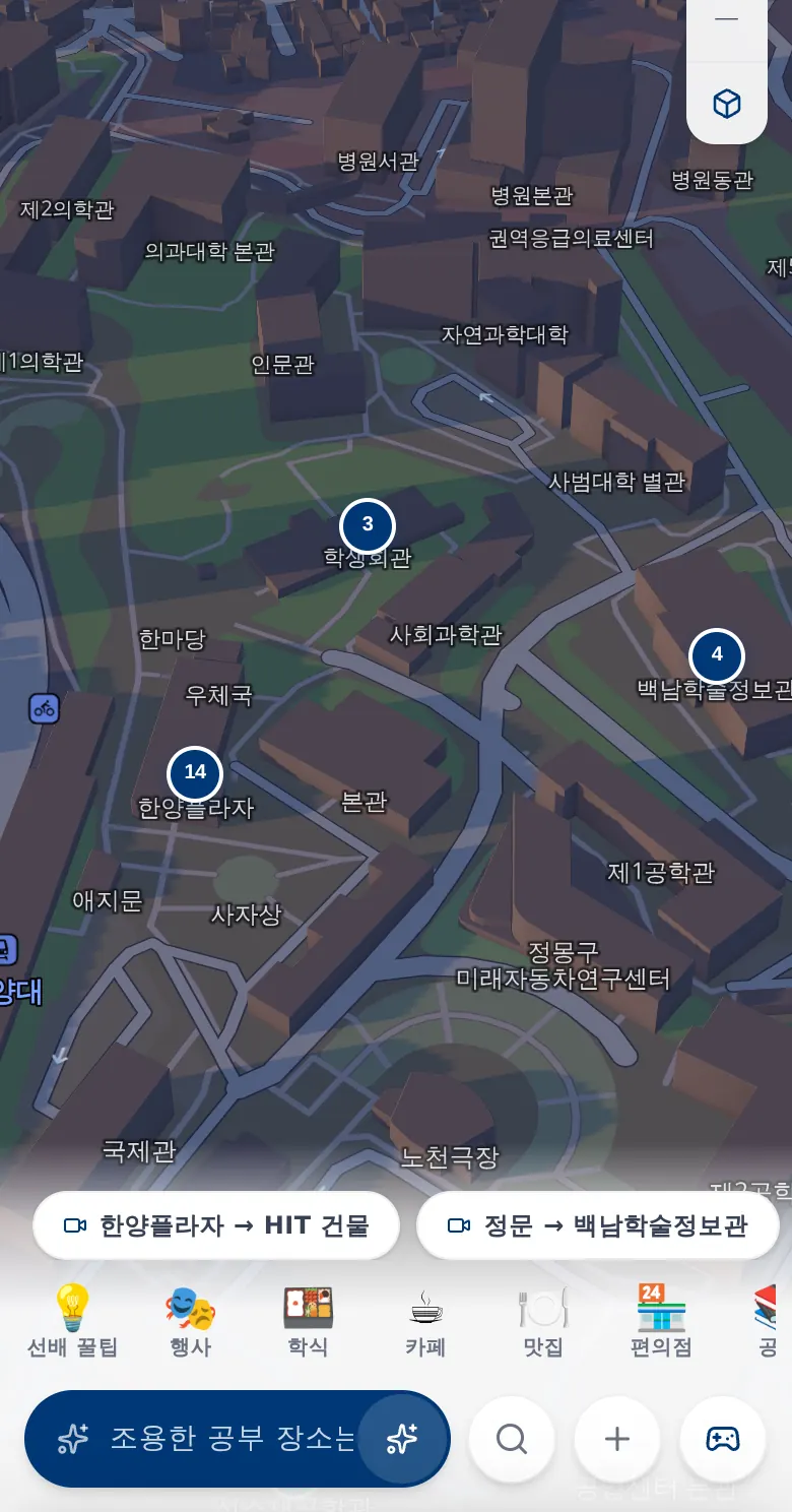
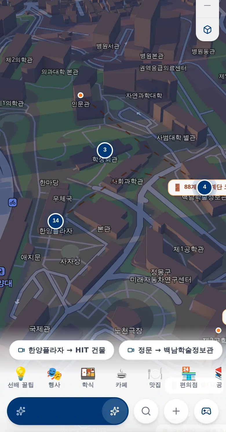
Wayo는 캠퍼스와 지역을 위한 디지털 지도를 만듭니다. 정문에서 강의실까지 이어지는 보행 경로, 장소 데이터에 근거한 AI 검색, 가입 없이 쓰는 방문객 안내, 그리고 GPS 미션까지 — 하나의 플랫폼에서.Wayo builds digital maps for campuses and regions — pedestrian routes from the gate to the lecture hall, AI search grounded in real place data, sign-up-free visitor guides, and GPS missions, on one platform.
지금 운영 중Live now
설명보다, 직접 열어보세요.Don't take our word for it. Open them.
01 / 캠퍼스01 / CAMPUS
캠퍼스를 위해 처음부터 다시 그린 지도.A map redrawn from scratch for one campus.
- 01 · 길Wayfinding범용 지도는 정문까지만 안내합니다.General maps stop at the main gate.
- 02 · 정보Information건물·행사·편의시설 정보는 PDF와 게시판에 흩어져 있습니다.Building, event and amenity info is scattered across PDFs and notice boards.
- 03 · 방문객Visitors처음 온 손님에게 앱 설치와 가입부터 요구하면, 결국 사람에게 다시 길을 묻습니다.Ask a first-time guest to install and sign up, and they'll just ask someone instead.
Wayo Campus는 캠퍼스의 실제 동선을 데이터로 만들어, 처음 온 사람도 길을 잃지 않게 합니다.Wayo Campus turns a campus's real walking paths into data, so first-time visitors don't get lost.
- S1
정문에서 강의실까지, 지하 통로까지.From the gate to the lecture hall — underground included.
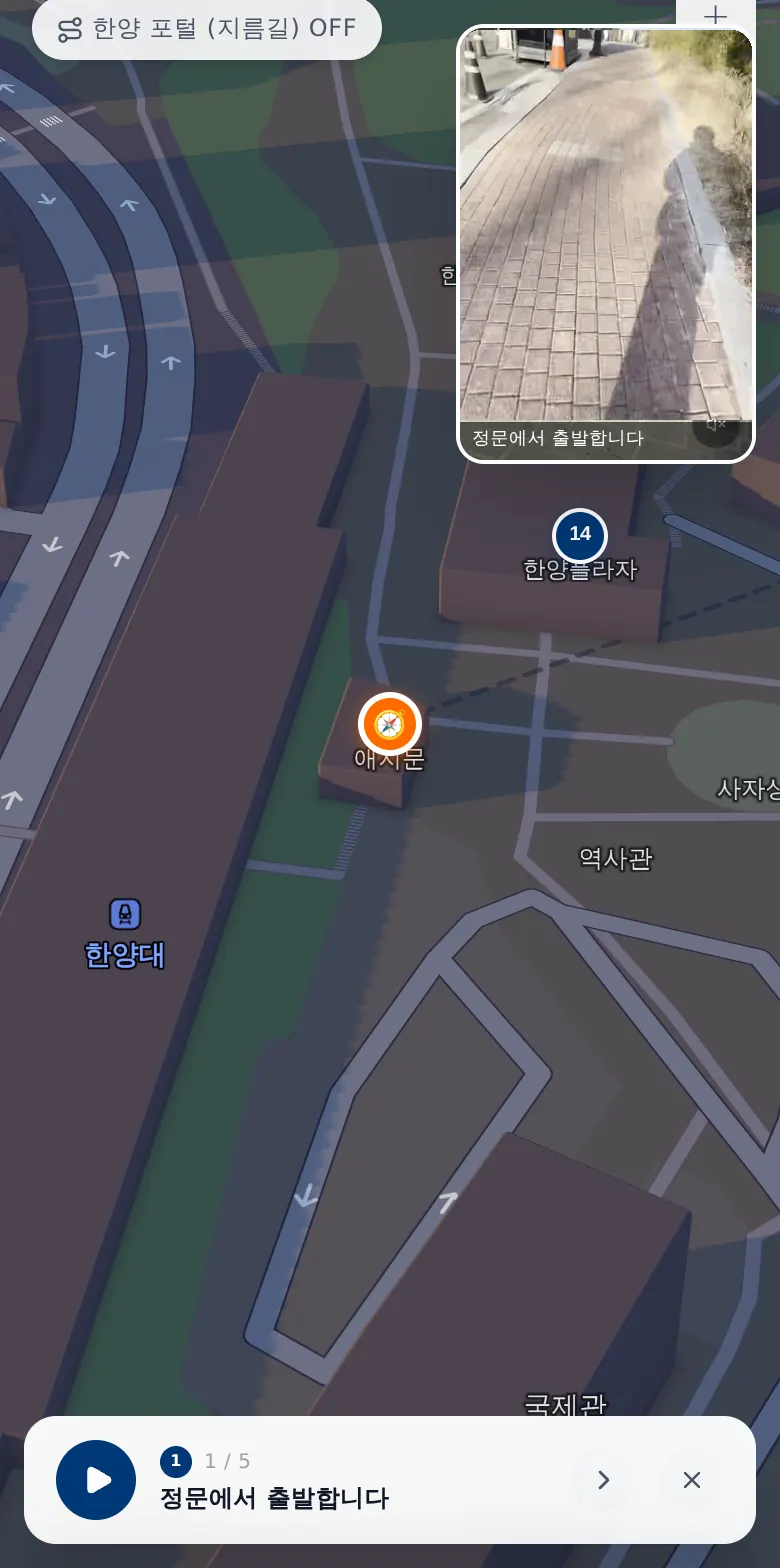
캠퍼스 게이트, 건물 출입구, 지하 연결통로를 잇는 보행 네트워크로 사람들이 실제로 걷는 길을 안내합니다.A pedestrian network linking campus gates, building entrances and underground connectors routes people along the paths they actually walk.
정문Gate지하 연결통로Underground강의동Lecture hall - S2
캠퍼스에 묻고, 지도로 답을 받으세요.Ask the campus. Get answers on the map.
평소 말하듯 질문하면 캠퍼스 데이터에 근거해 답하고, 관련 장소를 지도 위에 바로 보여줍니다.Ask in plain language. Answers are grounded in campus data, and the relevant places appear right on the map.
예시Example가장 가까운 프린터 어디야?Where's the nearest printer?
현재 위치에서 가까운 프린터가 있는 건물을 찾았어요. 지도에서 위치를 확인하세요 →I found buildings with printers near you. See them on the map →
- S3
가입 없이 쓰는 방문객 안내.A visitor guide with no sign-up.
초대 링크 하나로 영상 길안내와 찾아오는 길을 전달합니다. 방문객은 앱을 설치하지 않아도 됩니다.One invitation link delivers video routes and directions to campus. Visitors don't need to install anything.
전체 영상 보기Watch full route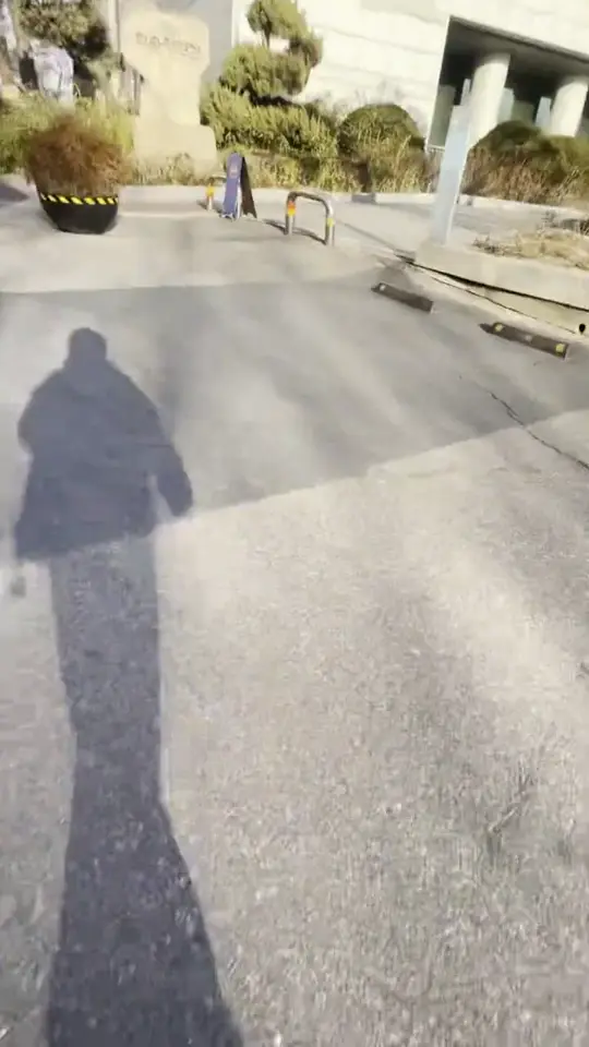
- S4
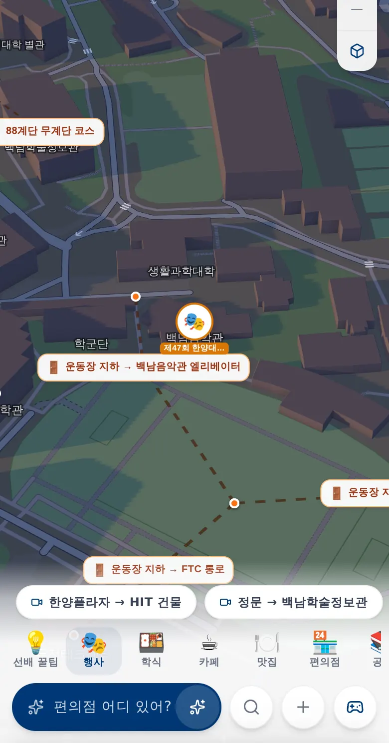
행사와 장소가 지도 위에.Events and places, on the map.
캠퍼스 행사, 편의시설, 커뮤니티가 제보한 장소를 한 지도에서 찾습니다.Campus events, amenities and community-submitted places, all in one map.
- S5
운영팀을 위한 관리자 콘솔.An admin console for the team that runs it.
행사 등록, 장소 제보 검토, 건물 정보 수정을 운영팀이 직접 관리합니다.Publish events, review place submissions and update building information yourselves.
예시 화면Illustration행사Events장소 제보Submissions건물Buildings- 검토 대기Pending review
- 검토 대기Pending review
- 게시됨Published
- 게시됨Published
- 게시됨Published
가장 가까운 프린터 어디야?Where's the nearest printer?
현재 위치에서 가까운 프린터가 있는 건물을 찾았어요. 지도에서 위치를 확인하세요 →I found buildings with printers near you. See them on the map →
- 검토 대기Pending review
- 검토 대기Pending review
- 게시됨Published
- 게시됨Published
- 게시됨Published
02 / 플랫폼02 / PLATFORM
하나의 지도, 겹겹의 레이어.One map. Many layers.
모든 Wayo 지도는 같은 구조 위에 만들어집니다. 그래서 캠퍼스에서 검증된 기능이 지역 지도와 행사로 그대로 옮겨갑니다.Every Wayo map is built on the same stack — so what's proven on a campus carries straight over to a region or an event.
- L1기본 지도Basemap건물·출입구·층 정보까지 정리된 장소 데이터Place data down to buildings, entrances and floors
- L2경로Routing지상과 지하를 잇는 보행 네트워크A pedestrian network linking surface and underground
- L3콘텐츠Places & events행사, 장소, 커뮤니티 제보Events, places and community submissions
- L4경험ExperiencesAI 검색, 영상 길안내, GPS 미션AI search, video routes and GPS missions
03 / 지역03 / REGIONS
지역과 축제를 위한 지도, 빠르게.Maps for regions and festivals — fast.
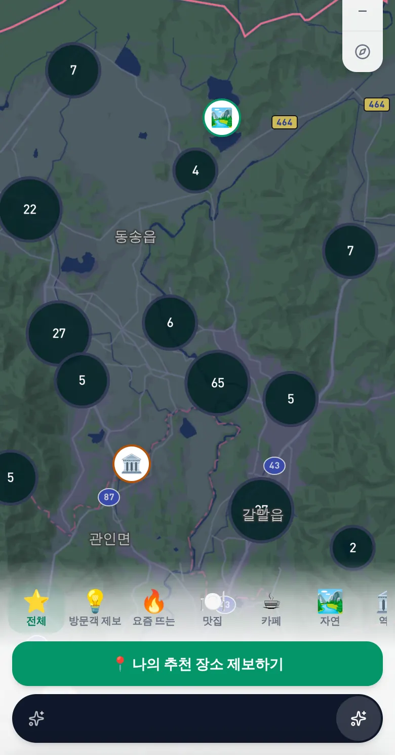
철원 여행 지도는 같은 플랫폼 위에서 만들어졌습니다. 지역 맞춤 지도, 지역 정보에 근거해 답하는 AI 가이드, 방문객이 직접 올리는 장소 제보. 지역이나 행사마다 복제해 새로 열 수 있습니다.The Cheorwon travel map runs on the same platform: a map tuned to the region, an AI guide that knows local information, and places submitted by visitors themselves. Fork it for any region or event.
- 지역 맞춤 지도A map tuned to the region
- AI 여행 가이드AI travel guide
- 방문객 장소 제보Visitor place submissions
- 지역·행사별 복제Forkable per region or event
- 캠퍼스Campus
- 지역Region
- 축제Festival
04 / 미션04 / MISSIONS
걷는 곳이 곧 무대가 됩니다.Where you walk becomes the game.
정해진 장소에 도착하면 미션이 열립니다. 퀴즈, O/X, 텍스트, 사진 — 참가 코드로 입장해 키워드로 팀을 이루거나 혼자 플레이하고, 실시간 리더보드로 겨룹니다.Missions unlock when players arrive at a place. Quiz, O/X, text and photo missions — join with an access code, form a team by keyword or play solo, and compete on a live leaderboard.
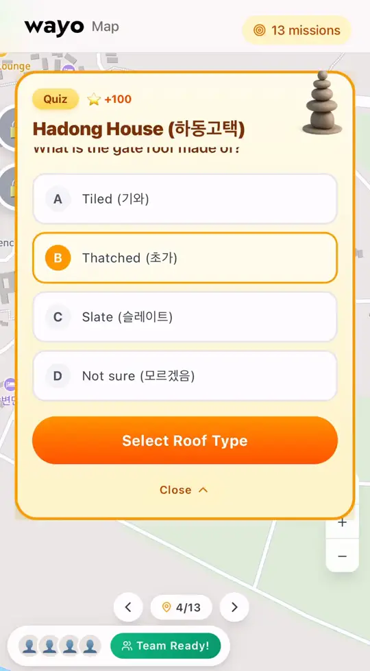
01 · 퀴즈Quiz 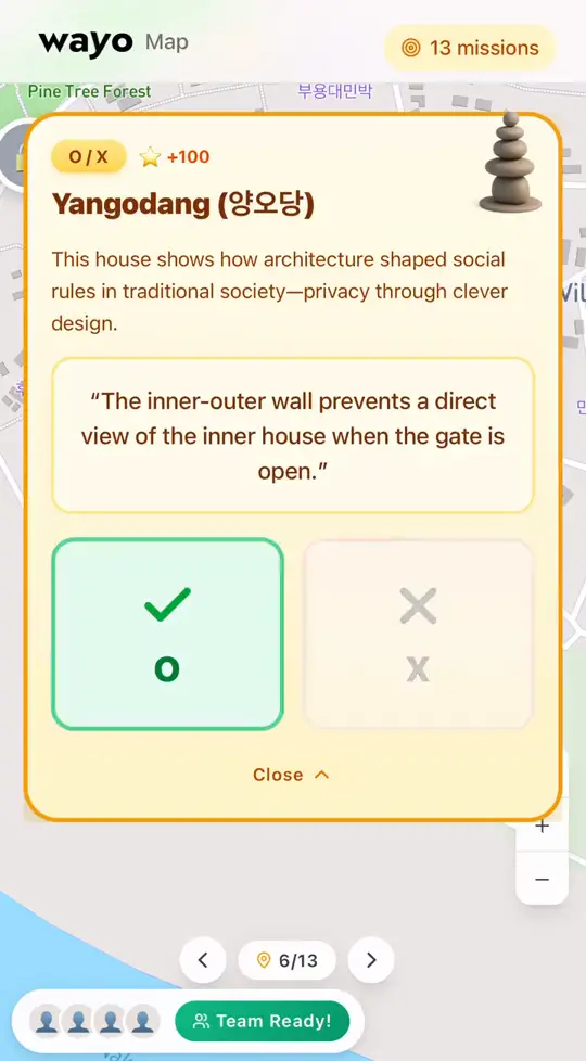
02 · O/XO/X 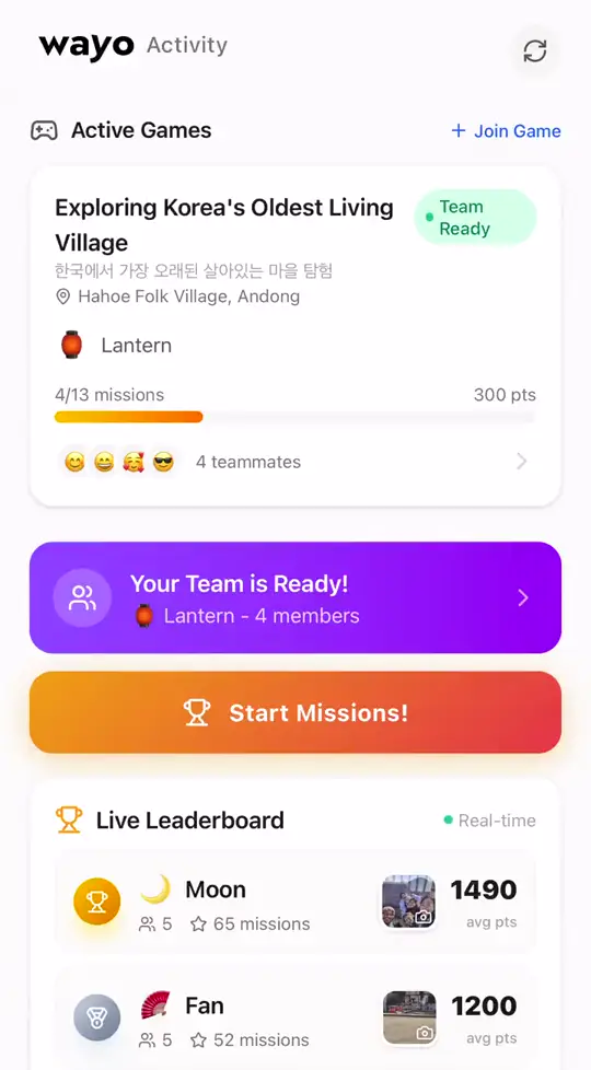
03 · 리더보드Leaderboard
- GPS 트리거GPS-triggered
- 퀴즈 · O/X · 텍스트 · 사진Quiz · O/X · Text · Photo
- 참가 코드 입장Access-code join
- 키워드 팀 매칭 · 솔로Keyword teams · Solo
- 실시간 리더보드Live leaderboard
- 운영자 라이브 대시보드Live admin dashboard
05 / 고객05 / WHO
장소를 운영하는 팀을 위해.For the teams who run places.
대학·기관Universities & institutions
신입생, 방문객, 행사 참석자가 처음부터 길을 찾는 캠퍼스.A campus where freshmen, visitors and event guests find their way from day one.
지자체·축제Local governments & festivals
지역의 장소와 이야기를 여행자가 직접 걸으며 만나는 지도.A map where travellers meet a region's places and stories on foot.
행사 기획Event organisers
참가자가 움직이며 참여하는 GPS 미션과 실시간 순위.GPS missions and live rankings that get participants moving.
함께 만드는 방식How we work
- 01
현장 데이터 구축Map the ground truth
건물, 출입문, 연결통로, 실제 보행 동선을 조사하고 영상 경로를 촬영합니다.We survey buildings, gates, connectors and real walking paths, and film video routes.
- 02
맞춤 구성Shape it to the place
공간에 맞는 디자인, 한국어·영어 안내, 필요한 기능을 구성합니다.Design fitted to the place, Korean and English guidance, and the features you need.
- 03
링크 하나로 공개Launch with a link
앱 설치 없이 웹 링크와 QR로 바로 열립니다. 방문객은 가입하지 않아도 됩니다.Opens from a web link or QR code, with no app install. Visitors don't need to sign up.
- 04
함께 운영Run it together
관리자 콘솔에서 행사, 장소 제보, 정보를 직접 관리하고, 지도는 계속 개선됩니다.Manage events, submissions and information from the admin console while the map keeps improving.
캠퍼스·지역·행사를 지도로 만들어 드립니다.Let's map your place.
캠퍼스, 지역, 행사 — 어떤 장소든 이야기 나눠요.Campus, region or event — tell us about your place.
캠퍼스 지도 체험하기 →Try the campus map →